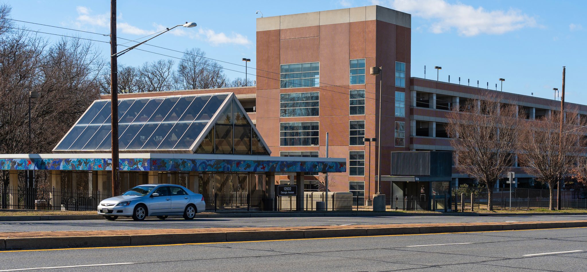
The Glenmont Corridors Opportunity Study looks at the community of Glenmont, specifically the parts of Glenmont that are within an approximate 1 mile walk from the Glenmont Metro Station. The community is at the juncture of two major Thrive identified growth corridors: Randolph Road and Georgia Avenue. This study seeks to identify strategies, services, amenities, and short-term actions necessary to support Thrive Montgomery 2050’s principles of corridor focused growth, complete communities, and 15-minute living in Glenmont.
Key focus areas will include assessing land use and zoning challenges, particularly the redevelopment potential of the Glenmont Shopping Center. It will also emphasize improving mobility by boosting Metro ridership, enhancing pedestrian and bike connections, and addressing safety concerns along the corridors.
Study Goals
The study aims to identify the infrastructure, services, amenities, and short-term actions necessary to support Thrive Montgomery 2050’s principles of corridor focused growth, complete communities, and 15-minute living in the Study Area.
Study Area Boundary
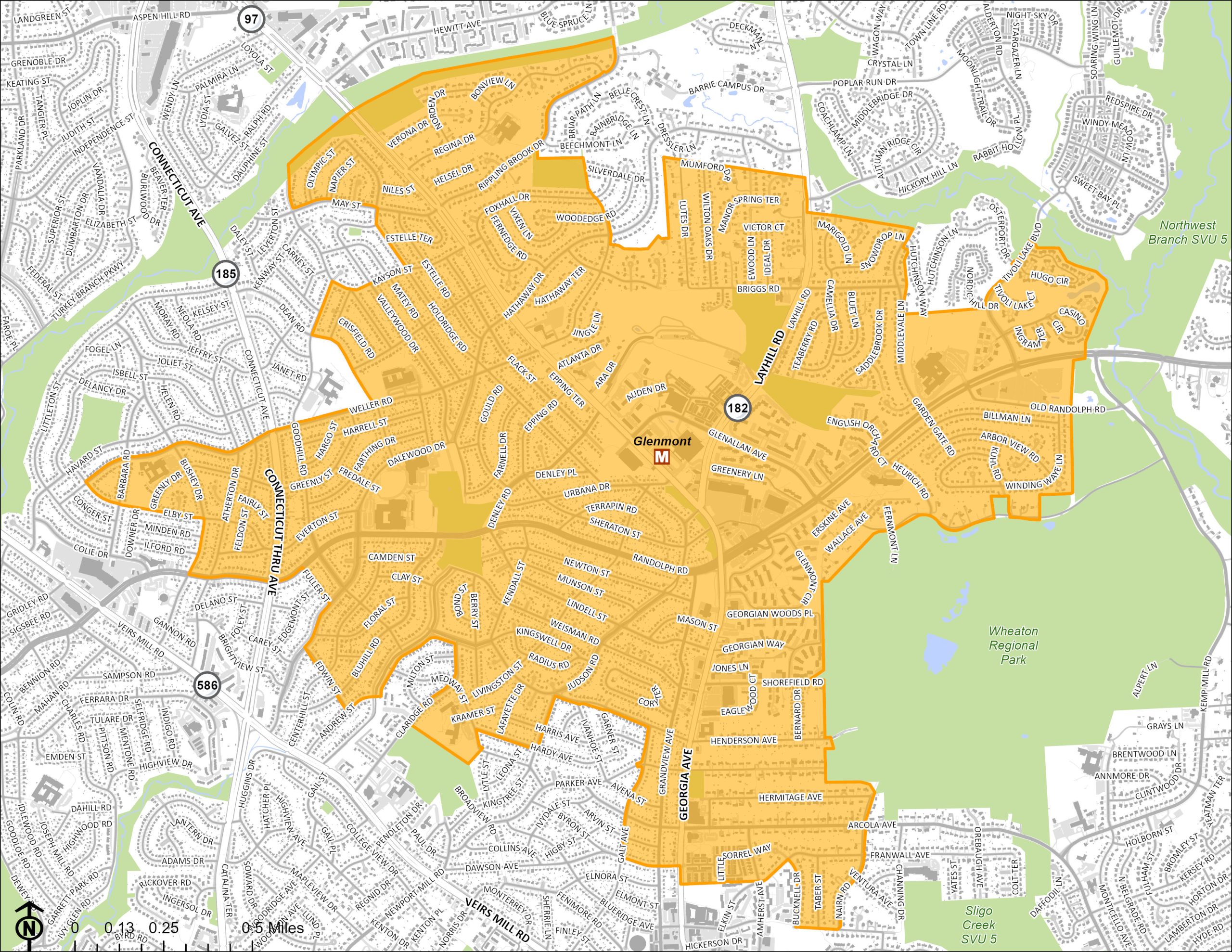
The study’s boundary includes the following overlapping geographies:
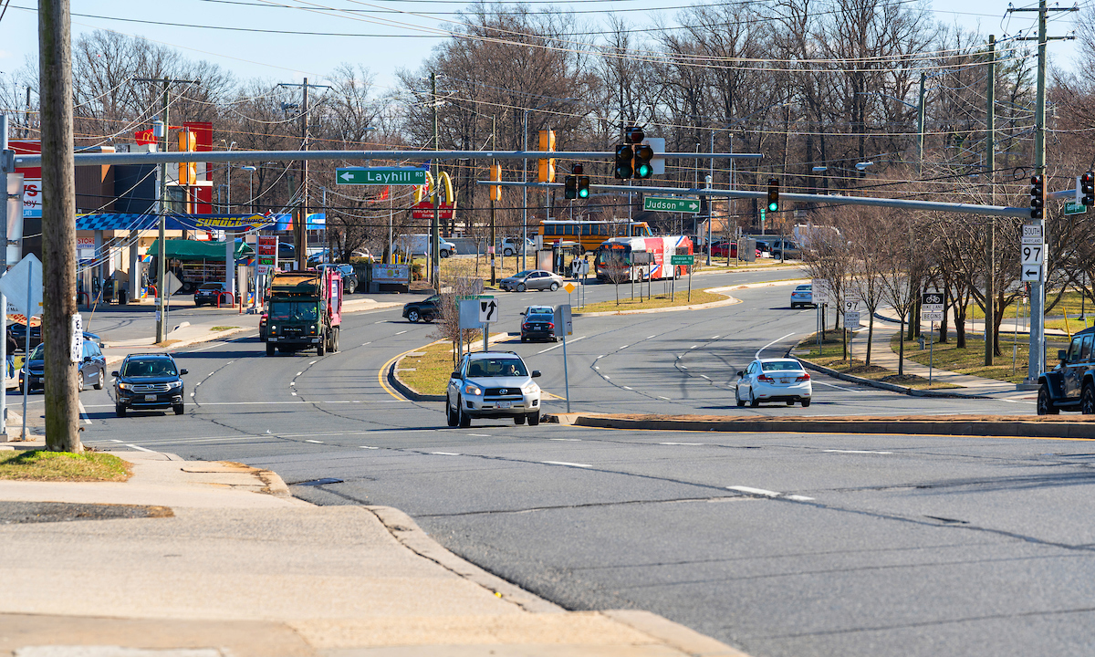
- Properties along the Georgia Avenue and Randolph Road corridors.
- The boundary of the 2013 Glenmont Sector Plan.
- Parts of Glenmont that are within a 20-minute, or roughly one-mile, manageable walk to and from the Glenmont Metro Station.
Study Process
The results of this study will be shared with the community and the Planning Board but it’s important to note, that unlike a master plan, studies conducted by Montgomery Planning do not change zoning. Montgomery Planning begins a study by collecting information about the people who live and work in the area and information about the area itself—its homes and businesses, its growth patterns and environmental needs, and its economic and physical relationships to the surrounding county. Through community engagement and correspondence with community organizations, local business owners, government entities, and other stakeholders, planners determine what the future of the area may look like and how we can best enable a version that is equitable, viable, and carries forward what people love about their community as-is.
Key Concepts of This Study
Complete Communities
“Complete Communities are places that include the range of land uses, infrastructure, services, and amenities that allow them to meet a wide range of needs for a variety of people.” Thrive Montgomery 2050 envisions Complete Communities as areas that encompass a variety of land uses, infrastructure, services, and amenities to cater to diverse needs. They are a key concept in the Thrive Montgomery 2050 plan, along with transit-oriented development and mixed-use zoning.
Corridor Focused Growth
Thrive Montgomery 2050 makes a new commitment to promoting growth along major transportation corridors for efficient land use in service of Complete Communities. Corridor focused growth aligns the intensity of development along the corridors with the urban, suburban, and rural context of the surrounding area and calibrated to account for existing or planned transit and other transportation infrastructure. Thrive recognizes that certain corridors possess the potential for growth and development throughout their entire length while others are more likely to experience such potential primarily as centers of activity or nodes along the corridor.
Outreach
Your voice matters in the development of this study. Planning staff will use a multi-pronged approach to outreach by seeking opportunities to meet one-on-one with neighborhood leaders, build working partnerships with civic groups, and connect with community advocates to identify and define community supported solutions for local challenges. Planning staff will also engage with the Washington Metropolitan Area Transit Authority, county stakeholders, advisory committees, major property owners, and residents to develop a better understanding of the elements listed in the above methodology. Planners will engage the community through online questionnaires, focus groups, and informal conversations with the community.
Project Timeline
-
Winter 2024Analysis and Audit
-
Spring 2024Comunity Outreach
-
Summer 2024Outreach Analysis
-
Fall 2024Recommendations Development
-
Late 2024Final Report