Urban Agroforestry Case Study: Utilizing Agroforestry in Floodplain Restoration Projects
By Katherine Favor, NCAT Agriculture Specialist
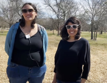
Leah Gibson, Conservation Program Coordinator with the City of Austin’s Watershed Protection Department, and Sari Albornoz, Community Engagement Planner at the City of Austin. Photo: Katherine Favor, NCAT
Abstract
Severe flooding is a significant hazard for the City of Austin, Texas, where much of the land base is in a floodplain. To prevent the loss of property and life, the City of Austin decided to purchase homes in dangerous floodplain areas, relocate residents to safer areas, and restore the floodplain buyout area in an ecological way. There are many options for restoring floodplain buyout land, and agroforestry is one that the City of Austin is utilizing.
Background
Approximately 10% of land in Austin is in either a 25-year or 100-year floodplain and is in danger of severe flash flooding. Much of this land currently has or previously had residential development on it, and in the inevitable event of a flood, the residents in these areas are in danger of experiencing loss of property and life. Homes in many of these areas have already been inundated repeatedly by severe flooding over the course of many decades, and the City of Austin is attempting to prevent this from happening again.
Doing nothing is not an option, but the solutions that cities have for dealing with floodplain areas are complicated. Sometimes, water channels can be modified so that homes can be spared, but in many cases, this isn’t feasible, so homes must be purchased and demolished. Leah Gibson, a Conservation Program Coordinator with the City of Austin’s Watershed Protection Department, explains, “When you talk about solutions to flooding, all the different possible solutions have their own positives and negatives. Buying out homes comes with one set of positives and negatives, whereas modifying the channel comes with a different set of positives and negatives. In the case of these particular sites, it was determined that a buyout and demolition process was the best way to proceed.”
The city has undergone several major buyout projects recently, including an 815-home buyout at the Lower Onion Creek floodplain, a 200-home buyout at the Upper Onion Creek floodplain, and a 52-home buyout at Williamson Creek. In every buyout project, there are many steps that go into the process before restoration can occur.
The City of Austin’s Steps for a Buyout Project
- Various flood-mitigation options are evaluated. If buyouts are determined to be the most practical solution, the City of Austin proceeds with a buyout project.
- The City informs residents about the buyout program and the opportunity to sell their homes.
- The City makes an offer to purchase homes based on comparable home prices. Homeowners participate in the buyout program on a voluntary basis.
- Houses undergo lead and asbestos testing.
- Homes are demolished.
- If it is determined that there is contamination on the site, the site may be considered a brownfield—defined as a property whose redevelopment or reuse may be complicated by the presence or potential presence of hazardous substances. If testing indicates that a site may be a brownfield, entities can apply for grants through the EPA’s Brownfields Program to develop a remediation plan and fund remediation activities.
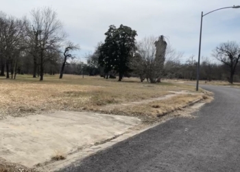
Driveway aprons in need of removal after a buyout demolition in the Upper Onion Creek floodplain. Photo: Katherine Favor, NCAT
Erosion matting is put down.
- Lots are seeded with native prairie seed mixes.
- Utilities are capped at the curb.
- The City determines which utility hubs need to stay to provide resources to nearby areas, and which utilities can be removed. Utilities can include fi beroptic cables, gas lines, water lines, transformer boxes, and more. Many public utilities, like water lines and electrical lines, will be removed by the City itself. In the case of private utilities not owned by the City, sometimes private companies must be contacted to remove the utilities.
- The City determines if leftover driveway aprons from demolitions are needed for water conveyance. If not, driveway aprons are removed and curbs are constructed
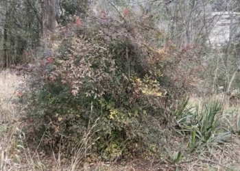
Harmful invasive species left over from landscaping after a buyout demolition. Removing invasive species is an important step in the process of restoring a floodplain buyout area. Photo: Katherine Favor, NCAT
Invasive plant species are controlled. Residential areas are often landscaped with invasive plants, and even after homes are demolished, these invasive species can persist. Managing leftover landscaped plants is an important part of the restoration process. Some landscaped plants, like native plants or fruit trees, can be good to keep, so it’s important for City ecologists to go through plants one by one and decide what can be kept and what must be removed.
- Old and damaged trees are removed. When private residential spaces are converted to public spaces, old and damaged trees instantly become a liability for cities. It’s important to remove and mulch dead or dying trees so that don’t become hazards to community members who will someday be using the space.
- The restoration project can begin!
Developing a Restoration Plan with the Community
Once buyout and demolition occur, there are lots of different options for what kind of restoration project to put into place. For any of these options, it is important that restoration plans be developed in partnership with community members, ecologists, floodplain engineers, and other key stakeholders, so that the project is safe and ecologically friendly and has community
buy-in. “The City has a challenge when it comes to how we are going to protect the people who live around this area, as well as the nature that we’re responsible for managing,” explains Leah Gibson. “The City of Austin’s Watershed Protection Department’s mission is to protect Austin residents from flooding, to reduce the negative impacts of erosion, and to protect
water quality. Any restoration project must, at minimum, satisfy all three of those goals.”
The first step in developing any restoration plan is to engage the community and get feedback on what they would like to see. Losing one’s home or seeing neighbors lose their homes can be a traumatic experience, but being involved in the process of restoring that land can be healing for the community. “It’s important for people to play a part in turning an emotional scar on
the land into a community asset,” says Gibson. One option for a restoration project is to simply plant grass and keep it mowed, and to allow the space to be used as a park. Another option is to sow native wildflower and prairie grass seeds, which can serve as a beautiful community feature, as well as habitat for wildlife. Other options include planting native trees to provide habitat for wildlife, increase water-holding capacity in the soil, stabilize loose soil, cool the surrounding microclimate, and provide other ecosystem services to the riparian ecosystem and the surrounding community. It may also be possible to install infrastructure for community gatherings, like shade structures and benches, as long as it is floodplain-compliant.
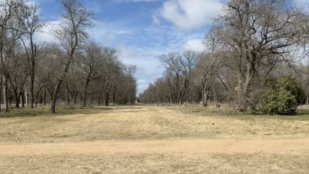
An example of a native-tree restoration project at the Upper Onion Creek floodplain. Photo: Katherine Favor, NCAT
Community agroforestry projects, such as public food forests or community orchards, are also a great option for restoration projects—one that the City of Austin is particularly interested in. Sari Albornoz, Community Engagement Planner at the City of Austin, explains that the City prioritizes restoration projects on floodplain buyout land that both restore the riparian ecosystem and foster community resilience. As part of her Master’s thesis, Albornoz explored the potential of using agroforestry in a floodplain restoration project because it has the potential to meet both these goals. There are several options for implementing community agroforestry projects, depending on what community members are interested in, what resources are available, and what is ecologically appropriate at a particular buyout site. One option is for the City to plant food forests, or community orchards, and for the community to steward them. Other options are for the City to lease land to individuals who want to develop for-profit perennial production farms, or to lease land to nonprofits that want to develop
educational or demonstration food forests. Many agroforestry options are possible for these kinds of sites, depending on what kinds of goals, resources, time, and money the community has.
Agroforestry as a Restoration Option
Agroforestry projects are great options for restoring urban floodplain buyout land because they have the potential to both serve the community and protect the environment. The trees in any type of agroforestry practice are useful for reducing the intensity of floods because tree roots hold earth in place, increase soil porosity, and increase soil organic matter, which leads to reduced erosion, increased water infiltration, and less runoff. Agroforestry practices like riparian forest buffers provide all these benefits and also provide habitat for wildlife, cool the water in streams, and increase the resilience of aquatic ecosystems. Agroforestry projects such as community orchards or food forests can provide all these benefi ts, and they can also provide a space for the community to gather, access free food, and enjoy nature in the middle of a city.
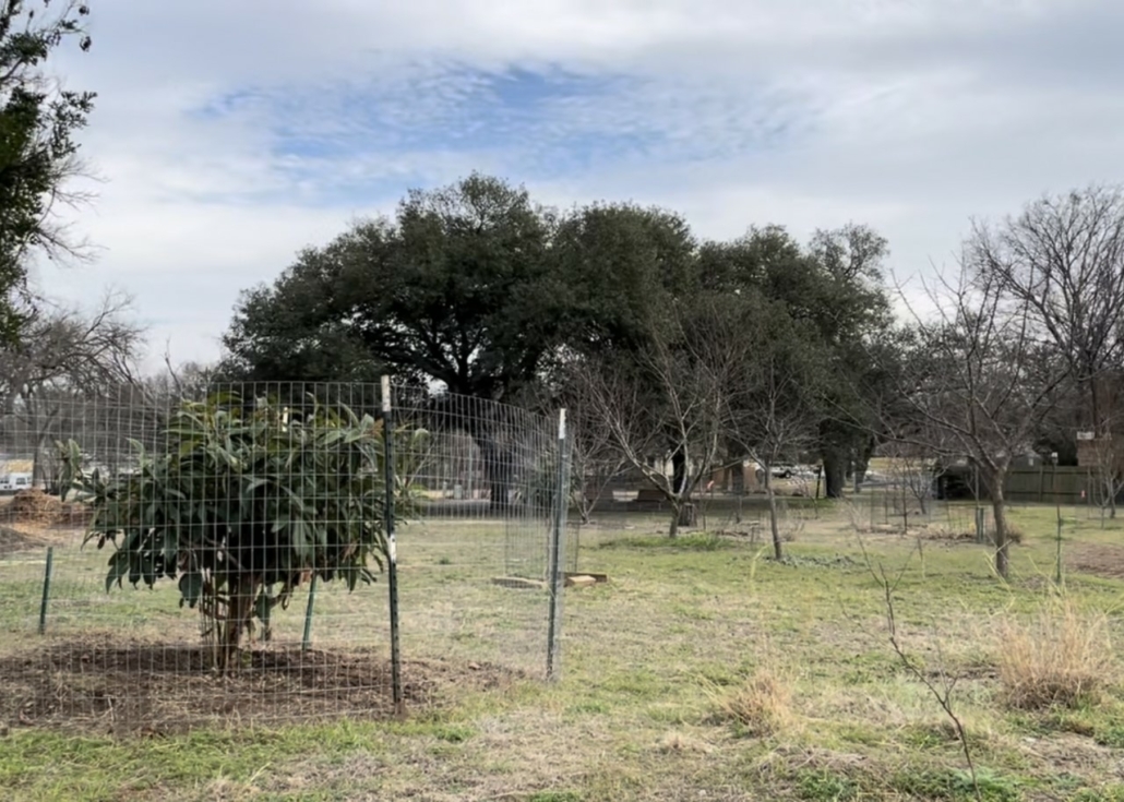
A community orchard restoration project in the City of Austin. Photo: Katherine Favor, NCAT
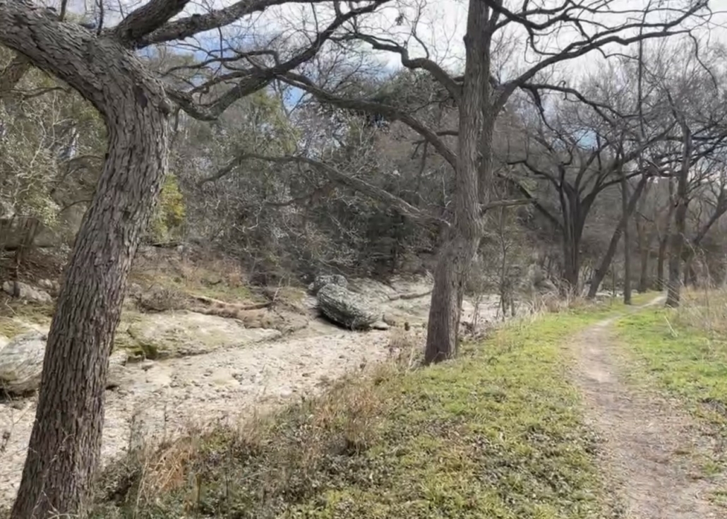
An example of riparian forest buffers near Williamson Creek, intentionally stewarded to stabilize soil, reduce erosion, increase infiltration, and protect riparian ecosystems. Photo: Katherine Favor, NCAT
Limitations
Parallel to the community visioning process to determine what kinds of projects the community wants to see, the City of Austin also does feasibility studies to see what restoration projects can realistically be put into action, as there are many limitations in floodplains. In this step, city planners, floodplain engineers, ecologists, arborists, and other experts are consulted in order to ensure that proposed restoration plans are floodplain-safe, good for the environment, and economically feasible.
The expertise of engineers is crucial to developing a project that is safe for floodplains, since these areas will inevitably experience some sort of flood event in the future. The engineers run models to project the velocity of water, depth of water, and duration of time that the water will remain on a given site, according to a variety of factors, and appropriate projects are determined as a result of these calculations. Even the number of trees planted, as in the case of an urban agroforestry
project, must be taken into consideration as part of this process. Planting too few trees can result in unstable and compacted soil, leading to erosion, reduced water infiltration, and increased flooding. However, on certain sites, planting too many trees can cause increases in flooding. In the event of a flood, trees can be uprooted, and too many uprooted trees could result in obstruction downstream, causing even more displacement of water. Floodplain engineers play a crucial role in determining how many trees are appropriate to plant on a given site, using models and metrics, such as the “roughness coefficient” to determine the correct number to plant.
In the case of restoration projects that involve producing food for consumption, like community orchards or food forests, additional soil tests must be done to determine if there are any contaminants in the soil. If there are, a remediation plan is needed, at which point the City’s Brownfields Revitalization Office can assist with remediating the site and can consult
with the EPA to provide guidance if needed.
For projects involving food-producing trees, additional issues, such as deer pressure, also must be dealt with in creative ways. Tall fencing can be washed away in the event of a flood, so only low-lying, open fencing that is floodplain compliant may be used. This type of fencing is not always effective for keeping deer out, so in cases like this, community agroforestry
projects might have to factor losses from deer into their projections.
No matter what the restoration plan is, it’s important to remember that this land will at some point experience a flood, so anything built or planted must be compliant with floodplain regulations. For example, no four-walled buildings can be built, because that would counteract the buyout demolition process. Some structures may be permitted on restoration sites,
but water must be able to flow through. This means things like storage sheds for tools, outdoor classrooms, and cold storage for crops must either have an open structure that lets water flow through, or they must be mobile. For example, a pull-behind shed on the back of a trailer would be acceptable infrastructure on floodplain buyout sites, but a permanent four-walled shed
would not be. In some cases, even benches might not be permitted unless they are chained or cemented down in a way that would reduce the likelihood of them being carried away in a flood. Many factors must be taken into consideration when putting anything on a floodplain site, and City of Austin floodplain engineers must review proposals for any restoration projects to ensure that proposed structures or items comply with floodplain regulations.
Carrying out a Restoration Project
Once a restoration plan is developed, resources must be gathered to put the project into action. In any restoration plan, there are resources that the city can contribute and there are other resources that must come from community members themselves or from outside grants. The City of Austin’s standard level of maintenance in floodplain areas is six lawn mows per year, but they can expand maintenance agreements to include a wide range of other management activities. Depending on what the community wants, these can range from planting trees to mulching, pruning, seeding with native prairie seed mixes, and watering trees.
For the community orchard that was implemented in the Williamson Creek buyout area, the City of Austin provided tree saplings, water for those trees during drought, deer fencing, and six grass mows per year to keep weeds at bay. Residents in the surrounding areas are responsible for pruning the trees, keeping up with additional weeding, harvesting, and other
management activities.
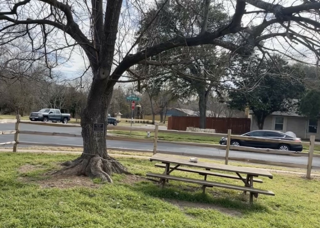
A floodplain-compliant table chained to a tree so it will not flow downstream in the event of a flood. Floodplain-compliant fencing is open, so that water is able to flow through. Photo: Katherine Favor, NCAT
Sometimes, community members might want to see additional infrastructure beyond just trees and plants in a restoration space, such as shade structures, running trails, or benches for community gatherings. When residents’ vision is beyond the Watershed Protection Department’s jurisdiction, the City of Austin sometimes coordinates with other departments, such as
the Public Works Department or Parks and Recreation, to provide additional resources for infrastructure. Cities can also apply for grants to do this kind of improvement. For example, in the case of Lower Onion Creek, the City of Austin received a grant from FEMA to pay for the materials and labor to install shade structures for recreational use.
With City approval, community members can also apply for grants themselves, if they want to develop projects that go beyond what the City can support. More than anything, their time and attention will be valuable assets for the sustainability of any project. Sometimes, community members organize volunteer days to maintain community gardens and orchards, while
other times, maintenance is less structured. As Leah Gibson says, “With the City’s resources, and the neighbors’ attention and love, we can see these areas become a wonderful community asset.”
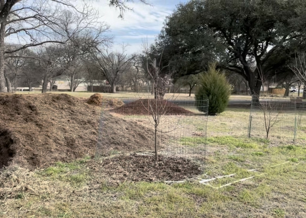
Saplings and mulch provided by the City of Austin at a floodplain restoration site. Photo: Katherine Favor, NCAT
Shade structures in the Onion Creek Floodplain, fi nanced through a grant from FEMA. Photo: Katherine Favor, NCAT
Urban Agroforestry Case Study: Utilizing Agroforestry in Floodplain Restoration Projects
By Katherine Favor, NCAT Agriculture Specialist
Published January 2023
©NCAT
IP631
Slot 670
Version 012723
This publication is produced by the National Center for Appropriate Technology through the ATTRA Sustainable Agriculture program, under a cooperative agreement with USDA Rural Development. This publication was also made possible in part by a cooperative agreement with the United States Botanic Garden, and by a grant from the U.S. Department of Agriculture (USDA), Forest Service, National Agroforestry Center, under the authority of the Cooperative Forestry Assistance Act of 1978. These institutions are equal opportunity providers, employers, and lenders. ATTRA.NCAT.ORG.
![]()